
Marine GeoSurvey &
AUV Geophysical Surveys
3,700+ dives completed, capturing over 130,000 line kilometres of survey data
Years of combined experience in marine survey, processing and interpretation
AUV-powered systems, built to survey shallow and nearshore water
Seabed mapping &
hazard identification
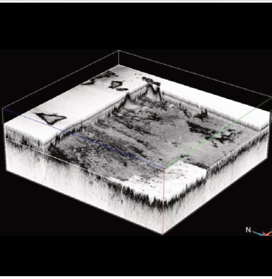
As specialists in seabed mapping, hazard identification, and 3D volumes of seabed profiles, we deliver comprehensive geophysical services. Safe, efficient, and informed marine operations are supported through advanced data acquisition, processing and interpretation.
The Marine GeoSurvey Division delivers advanced sub-sea geophysical surveys for offshore and near-shore mineral exploration. Using Autonomous Underwater Vehicles (AUVs) and conventional systems deployed from vessels of opportunity, we acquire and process high-resolution data for accurate seabed mapping and hazard identification. Our clients receive fully processed and interpreted results with rapid turnaround, enabling immediate application to inform business decisions.
With more than 20 years of experience and over 3,700 dives covering more than 130,000 line kilometres of survey data acquired, the Upstream Technology GeoSurvey Division offers a proven, flexible and cost-effective geophysical survey capability for complex offshore environments.
AUV operational
overview
High-resolution seabed and sub-seabed intelligence to support safe, efficient marine development.
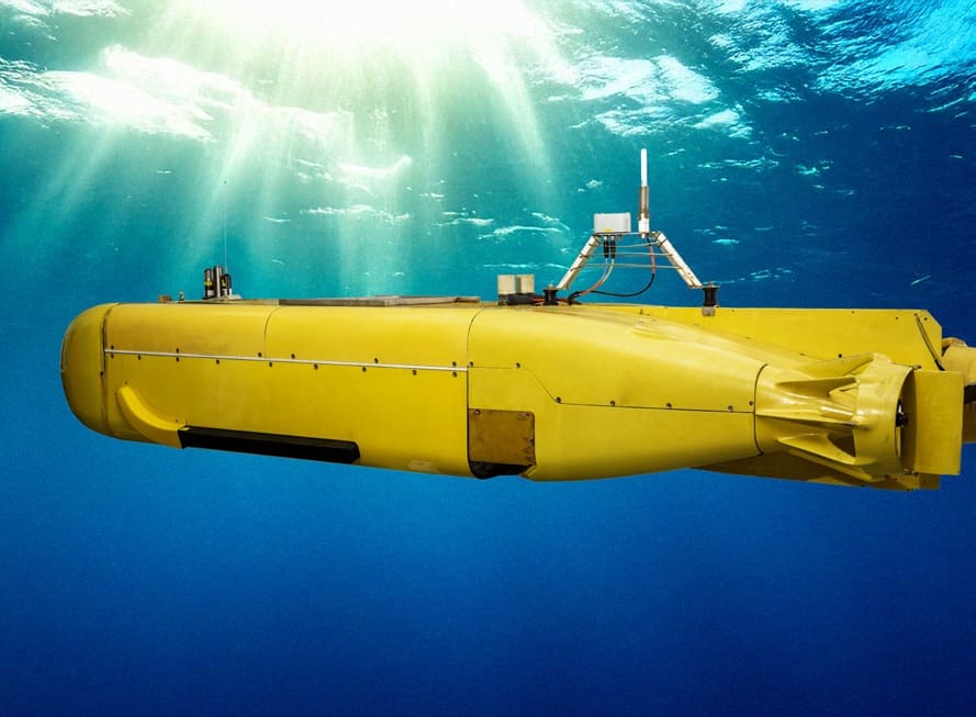
We operate two containerised AUVs capable of surveying at depths from 10 to 300 metres, flying at 10 m altitude. Each is equipped with 2D/3D Sub-Bottom Profiling (SBP), Side Scan Sonar (SSS), Multibeam Echosounder (MBE) and Magnetometer (MAG). Our chirp systems can detect subsurface layers up to 6 metres deep, depending on geological conditions, enabling fast, high-accuracy data capture even in challenging environments. Data is processed and interpreted in-house to support decisions across the exploration and mining lifecycle.
Each AUV is configured with an integrated multisensor payload that can be tailored to client-specific requirements, without limiting the ability to operate multiple sensors concurrently. Our AUVs feature an interchangeable payload bay with 0.11 m³ volume and 1.57 m² surface area, enabling integration of various sensors, including custom payloads tailored to client needs.
Containerised deployment from vessels of opportunity enables rapid mobilisation and significantly reduces vessel and logistics costs. Simultaneous multi-AUV operations increase survey coverage, improve schedule certainty, and lower cost per line kilometre.
What sets us apart
6 reasons to choose Upstream Technology for your GeoSurvey needs.
Efficient Survey Execution & Lower Cost per m²
Our streamlined operations deliver faster survey cycles, improved geological modelling, and reduced turnaround time, resulting in lower cost per square metre surveyed and more efficient campaigns.
High-Resolution Multisensor Data in One Pass
AUVs collect data from multiple sonar types (SSS, MBE, SBP) and subsea laser simultaneously, reducing vessel time and delivering cost-effective, high-resolution results.
Custom Payload Integration for Client-Specific Needs
Interchangeable payload bays allow integration of tailored sensors, including mosaicked imagery for environmental monitoring, enabling broader data collection and analysis per campaign.
Flexible Deployment from Smaller Vessels
Containerised systems enable rapid mobilisation from vessels of opportunity, drastically reducing costs and expanding access to remote or logistically complex sites.
Rapid Turnaround from Survey to Insight
Clients receive fully processed and interpreted results shortly after survey completion, enabling immediate decision-making and accelerating project timelines.
Dual AUV Operations for Maximum Coverage
Operating two AUVs simultaneously doubles survey coverage, reduces cost per line kilometre, and lowers the risk of downtime or survey failure.
AUV survey modes
From broad reconnaissance to high-resolution precision
Survey parameters are matched to your project goals: Reconnaissance for broad coverage and cost-effective insight, Standard for balanced detail and efficiency, and High Resolution for precision on critical decisions.
Survey mode | Reconnaissance | Standard | High Resolution |
|---|---|---|---|
Altitude | 20 m | 12–20 m | 10 m |
Line spacing | 100 m | 25–50 m | 2.7 m |
MBE resolution | 1 m | 0.3–0.5 m | 0.1 × 0.1 m |
SSS resolution | 0.3 × 0.3 m | 0.15 × 0.15 m | 0.12 × 0.12 m |
SBP resolution | 0.4 m | 0.4 m | 0.5 × 0.5 m |
SBP Z resolution | 0.02 m | 0.02 m | 0.04 m |
Advantages of our autonomous underwater vehicles
AUV surveys vs ship-based surveys
With a conventional system, a “tow fish” fitted with a sonar system is pulled behind a ship at the end of hundreds of metres of cable.
Our AUVs deliver 4x faster seabed coverage because of a drastically lower turning radius, and a rapidly deployable, cable-free design.
Advantage | AUV System | Conventional System |
|---|---|---|
Turnaround radius | 10 or 12 metres | 100s of metres |
Resolution & stability | High: close to seabed for detailed data | Lower: operate from surface, less precise |
Navigation | Precise inertial and acoustic systems | Dependent on surface systems |
Efficiency | 4x faster seabed coverage | Slower, larger turnarounds |
Deployment | Containerised: rapid, global-ready | Larger vessel dependency |
Multisensor operation | Multiple sensors simultaneously | Limited sensor integration |
AUV & sensor specifications
Maridan 600 AUVs with an integrated multisensor payload
The standard configuration includes Multibeam Echosounder (MBE), Side Scan Sonar (SSS), 2D and 3D Sub-Bottom Profilers (SBP), and Magnetometer (MAG). This flexible approach enables detailed seabed mapping and shallow geological characterisation.
AUV: MARIDAN 600
| Dimensions | 4.5 m × 1.2 m × 0.6 m |
|---|---|
| Weight | 1,600 kg |
| Depth rating | 600 m |
| Optimal speed | 3 kts |
| Endurance | 13–17 hours |
| Navigation | Sonardyne SPRINT-Nav 700 |
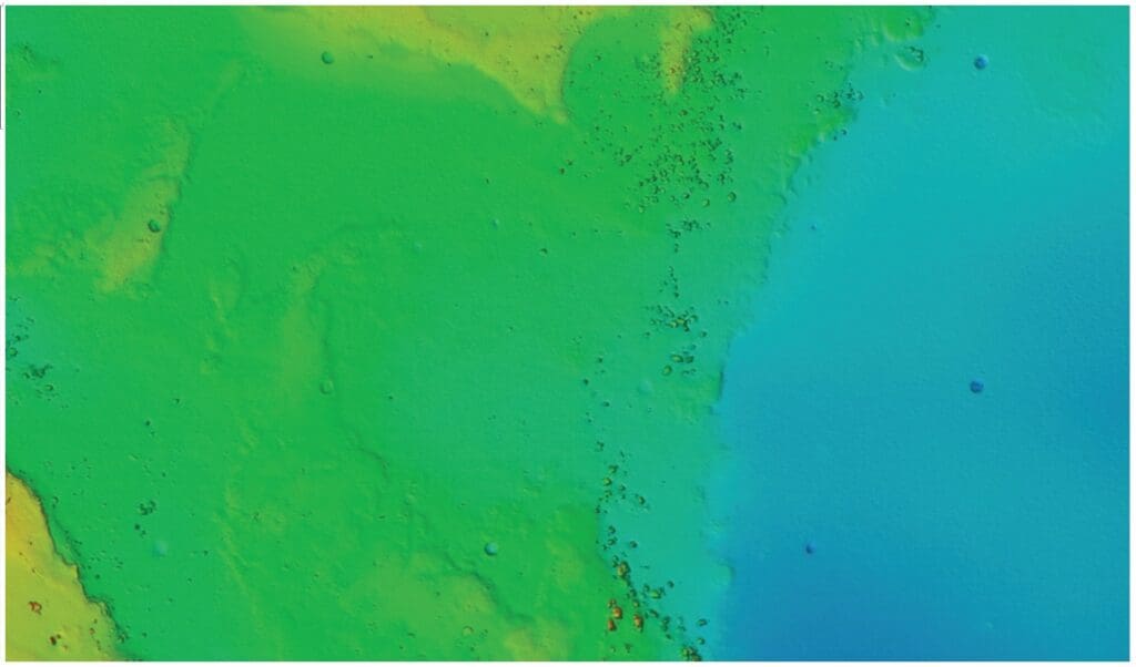
BATHYMETRY: R2SONIC 2024
| Frequency | Selectable 200 kHz – 400 kHz |
|---|---|
| Beams | 256 |
| Ping rate | Range dependent, up to 60 Hz |
| Backscatter | Recorded simultaneously with bathymetry data |
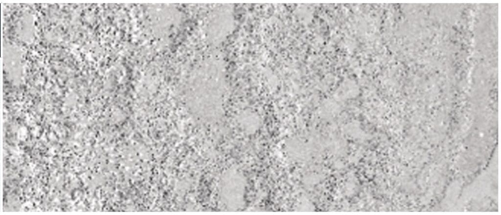
SIDE SCAN: KLEIN UUV-3500
| Frequency | 250 kHz |
|---|---|
| Range | Selectable 50 m – 300 m |
| Ping rate | Range dependent, up to 13.5 Hz |
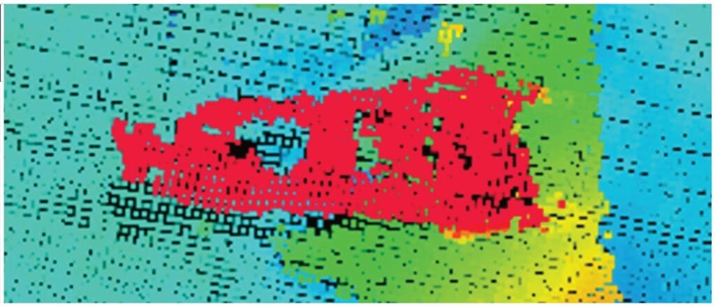
MAGNETOMETER: MARINE MAGNETICS SEASPY
| Measurement range | 18,000 nT – 120,000 nT |
|---|---|
| Sampling rate | 0.1 Hz – 4 Hz |
| Operating mode | AUV towed |
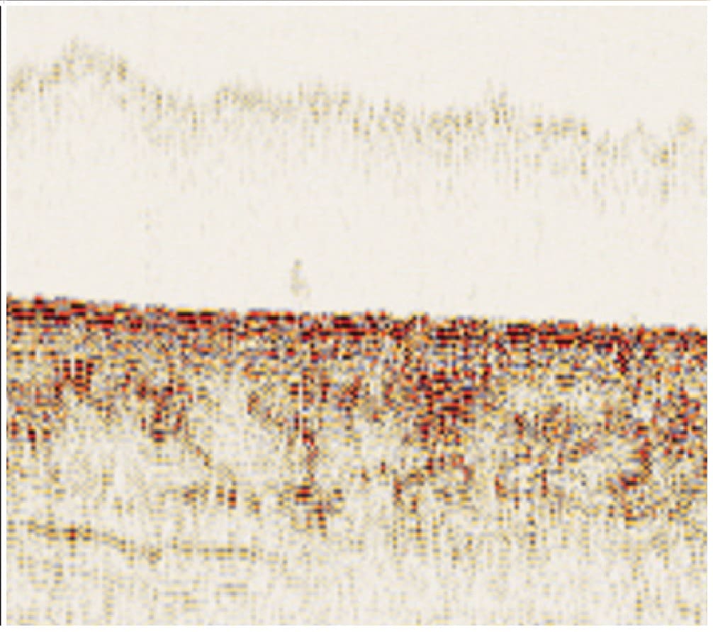
SUB-BOTTOM PROFILER: PROPRIETARY CHIRP BASED WITH 3D MODE
| Frequency | 2 kHz – 12 kHz |
|---|---|
| Ping rate | Selectable, up to 4 Hz |
| Sample interval | 40 kHz |
| 2D mode data | Time profiles |
| 3D mode data | Volumes, 0.5 m × 0.5 m spatial resolution |
Execution approach
Your project’s success is ensured by working together to minimise risks, optimise systems, and exceed expectations in terms of time, cost, and quality outputs.
1. Advanced Technology
Two AUVs equipped with advanced sonar and high-precision navigation systems, delivering sub-metre positioning accuracy.
2. Containerised AUV Operations
Launched from vessels of opportunity worldwide, improving flexibility and drastically reducing mobilisation costs.
3. Established Procedures
Proven survey planning, execution and QA processes.
4. Safety & Environmental Compliance
Fully aligned to marine regulations.
5. Lean Expert Team
The GeoSurvey Division comprises a highly specialised team of 13 experts spanning offshore and shore-based activities, divided into two key components: Shore-based Management and Support, and Offshore 24-hour Operations.
Our GeoSurvey team: each department brings a unique set of skills and responsibilities, ensuring seamless delivery of high-quality results.
Operations & Logistics Team. Manage logistics, resource allocation, project oversight, and maintenance to ensure efficient operations.
Survey Engineering Team. Operate, maintain, and optimise survey systems for seamless data acquisition.
Surveying Team. Plan, execute survey and post process data to secure precise positioning and accurate navigation.
Data Processing Team. Process and interpret high-resolution geophysical data to produce detailed seabed visualisations for complex offshore operations.
Additional offerings
Beyond AUV survey acquisition, the GeoSurvey Division supports offshore projects with specialist monitoring, positioning and data services.
Environmental Monitoring & Coring Solutions
Pipeline & Cable Laying Monitoring
Internal Data Processing & Interpretation
Industries we serve
GeoSurvey solutions are ideal for clients in targeted sectors including:
Offshore mining and exploration projects
Port authorities
Cable and pipeline installation firms
Ocean construction (e.g. offshore wind power)
Environmental monitoring bodies
Defence and hydrographic agencies
Dam infrastructure managers
Shipwreck and heritage research organisations
Get in touch with us for your next marine geophysical survey
As your survey and data acquisition partner, we deploy advanced, rapidly mobilised AUVs for accurate seabed mapping and hazard detection, delivering timely insights that support safe, efficient marine activities.
Partnering in technology for our future. Let’s solve the hard offshore challenges together.
Simangele Soni
Snr Business Development Manager
T: +27 10 346 5088
E: si************@**********up.com
Khanya Zilwa
GeoSurvey
T: +27 21 658 3229
E: kh**********@**********up.com
Michael Winstanly
Senior Technical Operations Manager
T: +27 21 508 9181
E: mi***************@**********up.com